Executive Summary
More than 1,500 new data centers are in various stages of development across the United States, with 67% of planned facilities slated for rural areas that have historically experienced little industrial hydrological stress. These facilities are routinely sited and permitted as individual projects, making their cumulative impact on regional aquifers, river systems, and impervious surface ratios nearly invisible to regulators until the damage is done. The four primary scientific frameworks available to assess such impacts — the Index of Watershed Integrity (IWI), the Hydroecological Integrity Assessment Process (HIP), the Ecological Limits of Hydrologic Alteration (ELOHA), and the Indicators of Hydrologic Alteration (IHA) — exist in mature, publicly accessible forms. The documented evidence shows they are not being applied in the data center permitting pipeline in any systematic, mandatory, or cumulative fashion. The consequences are already measurable in real watersheds.[^1][^2][^3][^4]
Part I: The Scale of the Threat
1,500 New Facilities, Mostly Rural, Mostly Unassessed
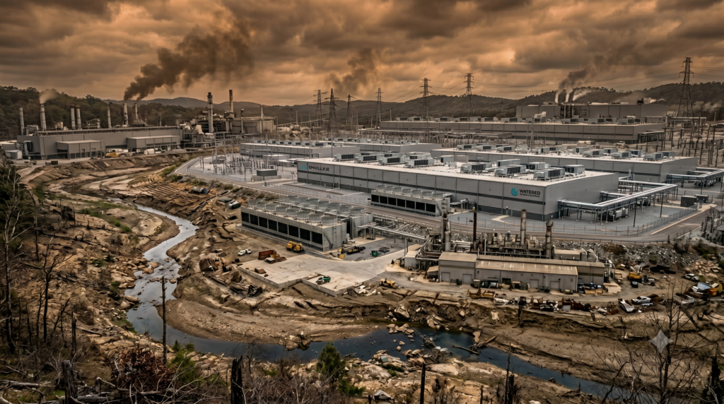
A Pew Research Center analysis of Data Center Map data, current as of February 2026, confirms that the United States already operates more than 3,000 data centers and has more than 1,500 additional facilities in various stages of development. Of those planned facilities, 67% are targeted at rural areas, compared to just 13% of currently operating centers — a fundamental geographic inversion in the industry’s footprint. Nearly 4 in 10 planned projects are entering counties that currently have no data center presence whatsoever, meaning they will be the first large-scale hydrological stressor in those local watersheds.[^3][^5][^6]
Regional concentration compounds the problem. Virginia leads all states with 287 planned data centers on top of 398 already operating, followed by Texas (170 planned), Georgia (141), Illinois (123), and Arizona (86). In the South alone, 754 new facilities are planned — a 62% increase over the region’s current total. In terms of raw capacity, the disclosed U.S. data center pipeline reached 241 GW at the end of 2025, representing roughly a 33% increase in active development from the 93 GW pipeline that ended 2024.[^7][^3]
Water Consumption: A Quantitative Baseline
A single medium-sized data center may consume approximately 110 million gallons of water annually for cooling, with some facilities drawing up to 5 million gallons per day. In aggregate, U.S. data centers directly consumed 66 billion liters in 2023, a figure the EPA projects will rise to between 144 and 276 billion liters by 2028. The Cornell University research group estimates that by 2030, current AI data center growth trajectories would drain 731 to 1,125 million cubic meters of water annually — equivalent to the household water usage of 6 to 10 million Americans.[^8][^9][^10]
The Alliance for the Great Lakes projects that hyperscale data centers alone will withdraw as much as 150.4 billion gallons of water over the five-year period from 2025 to 2030, the equivalent consumption of 4.6 million U.S. households. In Texas, a single-state study by the Houston Advanced Research Center estimated data centers would use 185 billion liters in 2025, rising to 1.51 trillion liters in 2030 — enough to reduce the level of Lake Mead by more than 4.8 meters in a single year.[^11][^8]
The Ceres “Drained by Data” report, using Phoenix as a regional case study, found that data center cooling operations in that metro area alone are projected to increase from 385 million gallons per year to more than 3.7 billion gallons per year — an 870% increase — as new facilities come online, while indirect water use from electricity generation could increase by 400%. Ceres further found that data center growth could increase water stress in already strained basins by up to 17% annually, with peak-season spikes even higher.[^12][^13]
The Rural-Watershed Hydrogeological Shock
The geographic inversion toward rural siting is particularly significant for hydrogeological integrity. Rural areas typically sit atop the undisturbed recharge zones that replenish regional aquifers. Recharge areas — open fields, forests, wetlands, and permeable soils — are precisely the surfaces that large-scale data center construction seals with impervious cover. Unlike surface water, aquifers recharge slowly, and when groundwater is pumped faster than natural replenishment rates, water levels drop, wells run dry, and groundwater-dependent ecosystems deteriorate.[^14]
Research has demonstrated that stream ecosystems and water quality begin to degrade measurably when more than 10% of the land within a watershed is covered with impervious surfaces, and sensitive species can be affected at even lower thresholds when impervious surfaces are located adjacent to water bodies. When the percentage of impervious cover exceeds 25%, degradation is severe and measurable across a wide range of biological indicators. A large data center campus — with server buildings, generator pads, parking infrastructure, and access roads — can collectively impose an impervious surface footprint of 50–70% or more over its developed area, directly blocking infiltration to whatever recharge zone it occupies.[^15]
The USGS has documented the hydrological mechanism clearly: impervious surfaces increase stormwater runoff volume and speed, reduce groundwater recharge, cause more frequent flooding, raise peak flow events, lower base stream flow, and lower water table levels. Impervious surfaces also retain and transfer heat, raising the temperature of stormwater runoff before it enters receiving waters — a compounding effect when combined with direct thermal discharge from cooling systems.[^16][^17]
Part II: The Four Assessment Tools — What They Can Do, and Whether They Are Being Used
The Index of Watershed Integrity (IWI)
Developed by the U.S. EPA and made publicly available through the StreamCat dataset, the IWI evaluates six watershed functions: hydrologic regulation, regulation of water chemistry, sediment regulation, hydrologic connectivity, temperature regulation, and habitat provision. It quantifies these functions against a suite of anthropogenic stressors — including impervious surfaces, reservoirs, and road-stream crossings — and provides cumulative values for all upstream activities at each location in the river network. The IWI is calculated and mapped for approximately 2.6 million watersheds across the conterminous United States, accessible through EPA’s StreamCat website.[^18][^19][^20][^21]
The IWI’s critical feature for data center analysis is precisely what its name implies: it measures integrity, not just individual stressor magnitudes. EPA researchers demonstrated that the IWI or Index of Catchment Integrity (ICI) are the best predictors of water quality across CONUS and six of nine ecoregions. A 2019 EPA revision of the IWI using random forest models found that the original IWI was likely an over-estimate of actual watershed integrity — meaning real conditions are worse than the baseline indices suggested. The StreamCat dataset currently contains over 600 metrics for approximately 2.65 million stream segments and their associated catchments.[^20][^22][^21]
Application to data centers: The IWI has been applied at regional and international scales (including transboundary river basins in the western Balkans), and has been used by municipal utilities for catchment-level management. However, no evidence exists of a mandatory IWI assessment in the U.S. data center permitting process at either the state or federal level. The tool is publicly available and technically capable of detecting cumulative impervious surface stress in targeted watersheds, but its use is entirely voluntary and, to date, systemically absent from data center siting approvals.[^18]
The Hydroecological Integrity Assessment Process (HIP)
Developed by the U.S. Geological Survey’s Fort Collins Science Center, HIP characterizes the five major components of the Natural Flow Regime using a Hydrologic Index Tool (HIT) that calculates 171 biologically relevant streamflow statistics, and a Hydrologic Assessment Tool (HAT) that determines departure from baseline conditions. Both tools are publicly available for download from USGS and allow the user to import daily and peak streamflow data directly from the National Water Information System.[^23]
HIP is designed specifically to quantify hydrologic alteration from a baseline (reference) condition — the exact analysis needed to establish whether data center water withdrawals, impervious surface additions, and thermal discharge are pushing a stream system outside its natural operating range. USGS has published full HIP applications for New Jersey, Missouri, and multiple other states, with state-level tools that can assess not just individual stressor impacts but cumulative flow modification over time.[^24][^25][^26]
The New Jersey Department of Environmental Protection has applied HIP-derived Ecologically Relevant Hydrologic Indices (ERHIs) to current and future regulation of New Jersey streams. This represents one of the few documented cases where HIP metrics have been formally integrated into permitting standards. No equivalent integration has been documented in states with the highest data center concentration — Virginia, Texas, Georgia, or Arizona.[^26]
The Ecological Limits of Hydrologic Alteration (ELOHA)
ELOHA is a consensus framework developed by an international group of scientists and published as a formal methodology in 2009. It addresses the core problem of scale: when in-depth hydrological studies cannot be conducted for every river in a region, ELOHA provides a scientifically defensible alternative by classifying rivers into flow regime types and developing flow alteration-ecological response relationships across each type. The framework explicitly accounts for cumulative effects by building a “hydrologic foundation” of baseline and current hydrographs for all stream and river segments in a user-defined region, then measuring the deviation of current conditions from that baseline.[^27][^28][^29]
Both HIP and IHA are noted as compatible tools within the ELOHA framework: “Both HIP and IHA can calculate the degree of hydrologic alteration between baseline and developed conditions. ELOHA uses statistical methods to select a small, manageable subset of non-redundant flow statistics for analysis of hydrologic alteration”. Several U.S. states have applied elements of ELOHA to accelerate environmental flow integration into regional water resource planning — including Minnesota and the South Atlantic region. A USGS-developed Unified Hydrologic Model for the South Atlantic already produces predicted natural baseline instream flows for all NHDPlus catchments in the region, altered flows under existing conditions, and future flow projections under urban growth and climate change scenarios.[^28][^30][^23]
In 2013, a published case study applied the ELOHA framework to regulated rivers in the Upper Tennessee River Basin, demonstrating the method’s utility for assessing hydrologic alteration and developing environmental flow standards in a region with large-scale water demands. That work is directly applicable to current conditions in heavily targeted data center states throughout the Southeast. Yet ELOHA has not been adopted as a mandatory screening framework in any state’s data center approval process.[^31]
Indicators of Hydrologic Alteration (IHA)
IHA, developed by The Nature Conservancy’s Brian Richter and colleagues (original framework 1996), is a software program that calculates 67 ecologically relevant measures of flow regime from long-term daily streamflow records. These measures cover five groups: magnitude of monthly flow, magnitude and duration of extreme flows, timing of annual extremes, frequency and duration of high and low pulses, and rate and frequency of condition changes. Together they describe the full range of ecologically significant aspects of a flow regime.[^32][^33][^23]
IHA’s pre-impact versus post-impact comparison function — producing a “scorecard” table quantifying changes in each parameter between baseline and developed conditions — makes it precisely suited for the data center cumulative impact problem. If used during the siting phase, it could identify whether a proposed facility is entering a watershed already showing measurable IHA deviation from its baseline condition, effectively functioning as a hydrological tipping-point detector.[^32]
The tool is currently used in academic research (including the ongoing Jager & Yoon 2026 data center freshwater biodiversity study from the University of Tennessee) and in state-level water withdrawal assessments in Michigan, but there is no documented instance of its mandatory application in a U.S. data center environmental review.[^34][^23]
Part III: The Regulatory Architecture — Why the Tools Are Not Being Applied
The Permitting Structure Fragments Cumulative Analysis
The fundamental structural problem is that data centers are permitted as individual projects under local land use authority, without any mechanism that compels — or even facilitates — cumulative watershed assessment. Virginia’s Piedmont Environmental Council articulated this concisely: “There is currently no way to assess the cumulative impact of data center water usage across the state”. Despite Virginia hosting more data centers than any other state in the world, as of 2023 its localities were approving proposals “without considering the cumulative impacts”. Data centers were not required to report water usage, and municipalities were not required to consider water use when approving new projects.[^2][^1]
The “approval gap” is structural and intentional. In most U.S. jurisdictions, data centers under a threshold electrical load — typically 5–10 MW in Florida, for example — can be deployed as by-right commercial uses without public hearings, environmental impact assessments, or community notification. Developers have increasingly exploited this gap by proposing multiple smaller facilities in the same watershed rather than single large ones, achieving the same aggregate footprint while individually remaining below the threshold for enhanced scrutiny. The cumulative impact of dozens of such facilities on a single watershed’s recharge area goes entirely untracked because “each individual facility seems modest in isolation”.[^35]
The Federal Rollback of Environmental Review
Executive Order 14318, signed by President Trump on July 23, 2025, explicitly directed federal agencies — including the EPA — to identify and create new categorical exclusions from the National Environmental Policy Act (NEPA) review process for “Qualifying Projects,” defined as data centers requiring greater than 100 MW of new load. The Council on Environmental Quality was directed to coordinate with agencies on establishing new categorical exclusions for Qualifying Projects that “normally do not have a significant effect on the human environment”. The Army Corps of Engineers was directed to consider nationwide permits under Clean Water Act Section 404 to “facilitate efficient permitting of activities related to Qualifying Projects” impacting waters of the United States.[^36][^37]
Critics — including environmental law scholars and some Republican legislators — have noted that the order essentially presupposes that large-scale data center development does not significantly affect the human environment, precisely the environmental determination that tools like the IWI, HIP, ELOHA, and IHA are designed to make. The Trump AI Action Plan, issued simultaneously, specifically targeted NEPA to streamline environmental assessments and permitting for data centers, introducing “categorical exclusions” to data centers in the name of “maximum efficiency”.[^38]
What State Reforms Have Been Achieved — and Their Limits
Virginia’s 2026 legislative session produced several relevant statutes. HB 496, signed into law on April 13, 2026 (effective January 1, 2027), requires water utilities to disclose in their DEQ reports the volume of water consumed by data centers, including both potable and reclaimed water. HB 94 requires applicants for new “high energy use facilities” to submit a site assessment before securing local land-use approvals. These represent genuine progress — Virginia DEQ announced that new legislation “effective July 1 will require data center water usage to be reported to DEQ”.[^39][^40][^41]
However, the watered-down version of HB 496 that actually passed removed the requirement for applicants to report expected water usage of new data centers, undermining the bill’s most forward-looking provision. Nature Forward noted that substitutions to the bill “not only roll back the intent of the original bill by removing the requirement to report on the expected water usage of new data centers, but also appear to further restrict what a locality can already do today”. These disclosures are backward-looking — they will track what data centers use after they are built, not whether proposed facilities push a watershed past its hydrological carrying capacity before construction begins.[^42]
West Virginia introduced HB 4683 in January 2026 — a bill explicitly designed to “prevent depletion of groundwater and aquifers” from data centers, prohibiting use of protected water sources, establishing monitoring and metering transparency, and requiring pre-construction hydrological analysis. The West Virginia House of Delegates rejected both an amendment to limit data center groundwater usage and a separate amendment to require water impact assessments prior to operation — both amendments were “overwhelmingly rejected”. WV HB 4683 itself stalled in committee.[^43][^44][^45][^46]
Part IV: Real-World Consequences Already Materializing
The Potomac River — A Case Study in Tipping-Point Dynamics
In April 2026, American Rivers named the Potomac River — which supplies drinking water for more than 6 million people in Maryland, Virginia, and Washington D.C. — the number one most endangered river in America, citing “the rapidly expanding footprint of water-intensive data centers across the watershed”. The Potomac watershed now hosts approximately 300 data centers. Loudoun County’s data center water usage alone represents 2–3% of total water withdrawals from the basin under average conditions, rising to 8% during peak summer months when cooling demand is highest. Monthly use is close to three times the average annual demand, with peak daily use as much as ten times average demand.[^47][^48][^1]
The Potomac Riverkeeper Network described the situation as a river “at a pivotal moment,” warning that the combination of data center expansion and aging sewage infrastructure “underscore the vulnerability of our river and our community’s drinking water”. This is precisely the “death by a thousand cuts” dynamic you described: no single facility is cited as the cause, but the cumulative hydrological alteration has rendered the river nationally recognized as being in crisis.[^49]
Unauthorized Water Use and Aquifer Depletion
In the first week of May 2026, two data center projects — one in Arizona and one in Georgia — were caught using public water without authorization, in communities already experiencing water stress. In Georgia, residents first noticed the problem when their water pressure dropped; in Arizona, the problem was discovered during dust control operations. A Meta data center in Newton County, Georgia reportedly impacted nearby private wells, forcing families to haul water and replace appliances clogged by sediment. Google’s data centers in The Dalles, Oregon (a city of 16,000 people) consumed 1.34 billion gallons in 2021 — approximately one-quarter of the city’s entire water supply.[^8]
Freshwater Biodiversity: The Biological Tipping Point
A 2026 study by University of Tennessee researchers (Jager & Yoon, published in Water Biology and Security) conducted a nationwide assessment of data center risks to freshwater biodiversity. The study found that in portions of the eastern United States, areas with high numbers of freshwater species directly overlapped with areas of relatively high water scarcity associated with data centers. These regions support diverse fish and mussel communities — many of which are already listed under the Endangered Species Act.[^34]
Thermal pollution is a particular concern. Data centers discharging warm water into receiving streams raise water temperatures, reduce dissolved oxygen levels, and stress cold-water species like trout and salmon at ecologically sensitive life stages including spawning migrations and larval development. The Forest Service’s peer-reviewed thermal modeling research found that urban river thermal pollution — caused by warm surface runoff from impervious surfaces, combined with lack of riparian forest, and heated subsurface flows — can suppress dissolved oxygen to 7.6 mg/L from a natural saturated level of 8.7 mg/L, creating stress thresholds for cold-water species and promoting eutrophication and hypoxic zones. This is a direct, documented, and modeled analog for the cumulative thermal impact of data center-dense development on rural river systems.[^50][^51][^34]
Part V: The Case for Mandatory Deployment
What a Proper Cumulative Assessment Would Look Like
The tools required to prevent or quantify the watershed damage described above already exist in publication-ready, publicly accessible form. A rigorous pre-construction cumulative assessment for a data center proposed in a previously undisturbed rural watershed would involve the following sequential steps:
- IWI baseline scoring via EPA’s StreamCat dataset for all catchments within the proposed development’s upstream contributing watershed, establishing current integrity scores across the six functions (hydrologic regulation, temperature regulation, chemical regulation, sediment regulation, hydrologic connectivity, and habitat provision).[^19][^21]
- IHA pre-impact characterization of daily streamflow at the nearest downstream gauge, establishing a 67-parameter baseline of the flow regime’s magnitude, frequency, timing, duration, and rate of change.[^23][^32]
- HIP hydrologic classification of the receiving stream, using the Hydrologic Index Tool to calculate 171 ecologically relevant flow statistics and classify the stream into its natural flow regime type, establishing what deviation thresholds constitute ecological impairment.[^52][^24]
- ELOHA regional context — placing the proposed facility within the larger regional flow alteration picture, using the framework’s hydrologic foundation to determine whether cumulative alterations across the watershed already approach or exceed the alteration-ecological response thresholds established for that river type.[^29][^27]
- Impervious surface ratio modeling using EPA’s place-based cumulative impervious surface tool and NOAA’s Nonpoint Source linkage methods to project the proposed facility’s impervious surface contribution as a percentage of its local recharge zone, against the documented degradation thresholds (10% for general degradation, 25% for severe degradation).[^53][^15]
The One Exception: Google’s Voluntary Framework
The only documented instance of a major tech company voluntarily deploying something resembling a watershed integrity framework in data center siting is Google’s 2023 “Water Risk Framework,” developed in collaboration with LimnoTech and a team of environmental scientists, hydrologists, and water sustainability experts. The framework evaluates “responsible use” by comparing current and future water demand against available supply, examining stream flow and groundwater monitoring data relative to healthy watershed benchmarks, and assessing whether a local water authority has rationed water use. Where a water source is assessed as “high risk,” Google pursues alternative cooling solutions — as demonstrated with the Mesa, Arizona data center, where the responsible-use evaluation identified the local water source at high risk, leading to an air-cooling decision.[^54][^55]
Google’s framework remains internal, voluntary, proprietary, and unenforced. It has not been adopted as an industry standard, incorporated into any permitting requirement, or made publicly available in a form enabling independent scrutiny of its application.
Part VI: The Structural Assessment Gap
The following table summarizes the current state of each tool’s availability versus its application in data center contexts:
| Tool | Developed By | Cumulative Capacity | Publicly Available | Mandatory in Data Center Permitting |
|---|---|---|---|---|
| IWI | U.S. EPA / StreamCat | Yes — aggregates all upstream stressors for 2.6M watersheds[^19][^20] | Yes (StreamCat) | No[^2] |
| HIP | USGS FORT | Yes — quantifies departure from baseline across 171 indices[^52][^24] | Yes (USGS download) | Partial (NJ only)[^26] |
| ELOHA | International scientific consortium | Yes — regional flow-ecology relationships for all river types[^27][^28] | Yes (open framework) | No[^23] |
| IHA | The Nature Conservancy | Yes — 67-parameter pre/post-impact scorecard[^32][^33] | Yes (software) | No |
The gap is not technical. The tools exist. The data infrastructure exists. The USGS StreamCat database covers 2.65 million stream segments. The National Water Information System provides daily streamflow records at thousands of gauges nationwide. The EPA has already mapped IWI scores for every watershed in the conterminous United States. What does not exist is any regulatory requirement that these tools be applied, cumulatively or otherwise, to data center siting and permitting decisions.[^22][^21]
At the federal level, the direction of travel is away from applying these tools, not toward it. Executive Order 14318 explicitly instructs agencies to develop categorical exclusions from environmental review for large data center projects, and the AI Action Plan directs agencies to grant exclusions to data centers to promote “maximum efficiency” in permitting. The Army Corps of Engineers has been asked to facilitate Clean Water Act Section 404 permitting efficiency for projects impacting waters of the United States — precisely the permits that would trigger the most rigorous watershed analysis.[^56][^37][^36][^38]
At the state level, Virginia’s HB 496 (effective January 2027) will require reporting on data center water use by utilities, but does not require prospective watershed integrity assessment prior to permitting. West Virginia’s attempt to require pre-construction water impact assessments was rejected. No state has incorporated IWI, HIP, ELOHA, or IHA as a mandatory screening requirement for data center applications.[^45][^41][^39]
The result is the scenario described in the query: cumulative depletion of aquifers and thermal warming of river systems across multiple overlapping watersheds, proceeding entirely within the bounds of individual facility permits, with the tipping points invisible to regulators until they have already been crossed.
Conclusion
The hydrological tools to prevent or document this damage are not hypothetical. They are published, peer-reviewed, publicly available, and in the case of the IWI, already mapped for every watershed in the continental United States. The question the evidence answers unambiguously is whether these tools are being deployed systematically in the data center permitting pipeline: they are not. The Potomac River’s 2026 designation as America’s most endangered river — driven substantially by data center growth — is the first large-scale empirical demonstration of the tipping-point dynamics that these tools were designed to detect before the tipping point is reached. The regulatory architecture, accelerated by federal deregulatory pressure, is moving in the direction of less scrutiny, not more. The result is a structural, legally facilitated, hydrogeologically irreversible experiment being conducted on the freshwater systems of rural America.[^47][^49]
References
- Piedmont Environmental Council Statement on the Potomac River … – This week, American Rivers released its 2026 list of most endangered rivers, and the Potomac River l…
- Mitigating Data Center Development’s Impacts – This explosive growth of data centers threatens to derail state efforts to meet climate goals, impro…
- Most new data centers in the U.S. are coming to rural areas – Over 1500 new data centers are in development nationwide. Most will be built in rural areas, particu…
- Pew Research: 67% of Planned U.S. Data Centers Headed to Rural … – The numbers reveal that 67% of planned data centers are slated for rural locations, compared to just…
- In a shift, most planned data centers in the US are in rural areas – A stacked bar chart showing that, in a shift, most planned data centers in the U.S. are in rural are…
- Data center growth shifts toward rural America, including the … – The U.S. has 3000 data centers, with growth driven by AI. A Pew Research Center report finds expansi…
- Newly Added U.S. Data Center Capacity Slows Down Considerably … – A total of 25 gigawatts of new data center capacity was added in Q4 2025, half of Q3 additions, “sig…
- Data centers in the US even steal groundwater from deserts in rural cities – In the first week of May, two data center projects, one in Arizona and the other in Georgia, were ca…
- Data Center Water Use and Its Environmental Impact – AKCP – Uncover the truth behind data center water use and its significant impact on resources and the envir…
- ‘Roadmap’ shows the environmental impact of AI data center boom – It would also drain 731 to 1,125 million cubic meters of water per year – equal to the annual househ…
- [PDF] A Finite Resource – Alliance for the Great Lakes – At the same time, demand from data centers, critical minerals mining, and agriculture is putting mor…
- Drained by Data: The Cumulative Impact of Data Centers … – Founded in Phoenix, Ariz. but relevant across the world, this report dives into the growing stress o…
- Drained by Data 2025 | PDF | Data Center | Water Scarcity – Scribd – The report by Ceres highlights the significant water stress caused by the rapid growth of data cente…
- Balancing Growth and Groundwater: What Data Centers Mean for … – Recharge areas are the places where rainwater and snowmelt soak into the ground and gradually filter…
- [PDF] The Impacts of Impervious Surfaces on Water Resources, NHEP – This provides the plants with the moisture that is needed for survival and increases groundwater rec…
- [PDF] Linking Land Cover to Water Quality
- [PDF] Urban Hydrology—Science Capabilities of the U.S. Geological Survey
- Adapting the Index of Watershed Integrity for … – Risk Assessment – Impact/Purpose. The EPA’s Index of Watershed Integrity (IWI) is used to calculate and visualize the …
- [XML] https://edg.epa.gov/data/public/ORD/NHEERL/WED/GEO/StreamCat …
- Revising the index of watershed integrity national maps – Watersheds provide a range of services valued by society, incorporating biotic and abiotic functions…
- Mapping watershed integrity for the conterminous United States – Watershed integrity is the capacity of a watershed to support and maintain the full range of ecologi…
- The StreamCat Dataset: Accumulated Attributes for NHDPlusV2 (Version 2.1) Catchments for the Conterminous United States: Index of Watershed Integrity / Index of Catchment Integrity (IWI/ICI) – StreamCat Dataset – Catalog – StreamCat currently contains over 600 metrics that include local catchment (Cat), watershed (Ws), an…
- Examples of Hydrology Assessments for Watershed Health | US EPA – This page guides to develop a watershed health index for Hydrology assessment
- SIR2007-5206 – USGS Publications Warehouse – Development of the Hydroecological Integrity Assessment Process for Determining Environmental Flows …
- Application of the Hydroecological Integrity Assessment Process for … – The process starts with the identification of a hydrologic baseline (reference condition) for select…
- Hydrodynamic Flow
- The ecological limits of hydrologic alteration (ELOHA) – The flow regime is a primary determinant of the structure and function of aquatic and riparian ecosy…
- Without Side.qxd
- Ecological Limits Of Hydrologic Alterations (Eloha) – Abstract. The ELOHA framework aims to develop quantitative relationships between flow regime alterat…
- MN ELOHA report & Case Studiesx
- Application of the ELOHA framework to regulated rivers in the Upper Tennessee River Basin: a case study – PubMed – In order for habitat restoration in regulated rivers to be effective at large scales, broadly applic…
- [PDF] Indicators of Hydrologic Alteration – GovInfo
- GitHub – iGW-TU-Dresden/IHA_parameters: Indicators of hydrological alteration calculated in Tesfalem et al. (2023, J.hydrol; Reg studies) The 32 IHA parameters describe the whole range of ecologically significant aspects of the flow regime, such as magnitude, frequency, timing, duration, and rate of change. – Indicators of hydrological alteration calculated in Tesfalem et al. (2023, J.hydrol; Reg studies) Th…
- Are data centers a threat to freshwater fisheries? – NC Sea Grant – Energy and water demands from AI infrastructure affect waterways and habitats.
- The Approval Gap: What Size Data Centers Escape Public Scrutiny – Data centers under 10 MW deploy without public hearings in most Florida jurisdictions. Aggregate imp…
- Beat the AI Clock: Federal Initiatives to Accelerate Data Center … – Beat the AI Clock: Federal Initiatives to Accelerate Data Center Environmental Permitting and Brownf…
- Accelerating Federal Permitting of Data Center Infrastructure – Environmental Quality any categorical exclusions to the National Environmental Policy Act (NEPA), co…
- With AI plan, Trump keeps chipping away at a foundational environmental law – When big infrastructure projects spring up, one crucial law — the National Environmental Policy Act …
- Virginia 2026 Legislative Session Environmental Highlights – During the 2026 legislative session, Virginia’s General Assembly passed an avalanche of new environm…
- DEQ News Vol. 5, No. 4
- Bill tracking in Virginia – HB 496 (2026 legislative session) – FastDemocracy – Certain data from water users; water use consumption for domestic, etc., purposes, data centers.
- House of Delegates Speak
- [DOC] hb4683 intr.docx – West Virginia Legislature
- HB 4683 Text – Bill Status – Bill Text
- House Approves Data Center Rules – West Virginia Public … – After the approval of microgrids to power data centers last year, the House of Delegates advanced a …
- Bill tracking in West Virginia – HB 4683 (2026 legislative session) – Prevent depletion of groundwater and aquifers
- Potomac River Leads 2026 List of America’s Most Endangered … – American Rivers is today naming the Potomac River as number one on our America’s Most Endangered Riv…
- Potomac River tops list of country’s most endangered rivers – The Potomac River tops the list of most endangered rivers in the country, according to a report that…
- America’s Most Endangered River of 2026 – The Potomac River has just ranked #1 on America’s Most Endangered Rivers® LIST of 2026 from American…
- How Does Data Center Heat Discharge Affect Local Water … – Discharging warm water (thermal pollution) raises local water temperatures, reducing dissolved oxyge…
- A model to integrate urban river thermal cooling in …
- USGS Publications Warehouse – Managing rivers and streams to maintain healthy aquatic ecosystems is a challenge for resource manag…
- A PLACE-BASED TOOL FOR ASSESSING CUMULATIVE IMPERVIOUS
- Assessing watershed health in data center host communities | Google Cloud Blog – To answer whether water cooling is environmentally responsible, we built a framework to assess the w…
- Assessing watershed health in data center host communities – To answer whether water cooling is environmentally responsible, we built a framework to assess the w…
- Fact Sheet: President Donald J. Trump Accelerates Federal … – ACCELERATING DATA CENTER INFRASTRUCTURE DEVELOPMENT: Today, President Donald J. Trump signed an Exec…